OVERVIEW
Region :- Himanchal
Duration :- 5 Days
Grade :- Easy To Moderate
Max Altitude :- 14,100 Ft.
Approx Trekking Km :- 26 Kms.
Himachal Pradesh is one of the most toured states in India. The state has beautiful pristine snow clad mountains which are a major source of tourist attraction. Tourists from all over the world come to this glorious, unpolluted and serene place to nurture their mind and soul and cherish an unfathomable nature's beauty. The word 'Hima' means snow in Sanskrit and hence the name Himachal Pradesh which means 'In the lap of Himalayas'. The mountains of the state are used for many adventure sports. One among them that is considerably being carried out here is trekking.
With more than 200 defined trekking trails some of the famous trekking spots of Himachal Mountains are; Hampta Pass trek, Dhaulandhar (Triund Glacier)trek, Parvati valley trek, Bhabha pass trek, Sari Pass trek, Beas Kund trek, trek to Chamba and Pin Parvati, Kakeri lake trek etc.
Hampta pass trek is considered the easiest and convenient of all treks in H.P. It might not be the most adrenalin rush giving or the most sought after trek, but definitely it is a trek that will leave you in awe of this beautiful place. The variation in the trails is enormous; scenic landscapes, open green pastures and meadows, glacial valleys, easy access and an exceptional, adventurous and hair raising crossing of the pass makes this trekking expedition to Hampta pass an exciting one.
Other attractions include, the temple at Osla which is dedicated to Duryodhana, was built by the inhabitants of Saur. It is about 13km from Sankri which lies on the steep mountain trail to Har Ki Doon. It is a 5,000-year formation of wooden chambers that are carved elegantly.
Generally, it takes 4 days to complete the Hampta pass trek, but one more day is further added to the itinerary so as to visit the well-known and striking Chandrataal, a high altitude alpine lake few hours from Chatru. The best months to trek are May and June and August through October. The reason why Hampta pass is famous trekking zone is snow; the pass has lump sum snow which draws more tourists.
Short Itinerary
Day 1: ManaliTo Chika Via JobraDay 2: Chika to Balu ka ghera
Day 3:Balu ka ghara to Siagoru, Crossing (Hampta Pass)
Day 4: Siagoru to Chhatru drive to Chandratal
Day 5: Chatru to Manali via Rothang Pass
Note: You can visit Chandratal If road and weather condition permits us. if not, you will have to drive directly from Chatru to Manali
Detailed Itinerary
Day 1 - Manali to Chika via Jobra
The trekking expedition starts from Manali to Jobra in vehicle. Manali is already at an elevation of 6, 700 ft above sea level. So, it is a good place to acclimatize your body before beginning the trek. It takes two hour and forty hairpin bends to arrive at Jobra. Jobra is at an altitude of 9, 800 ft. On the first day you will reach a height of 10, 100ft and cover up two to three hours of trek.
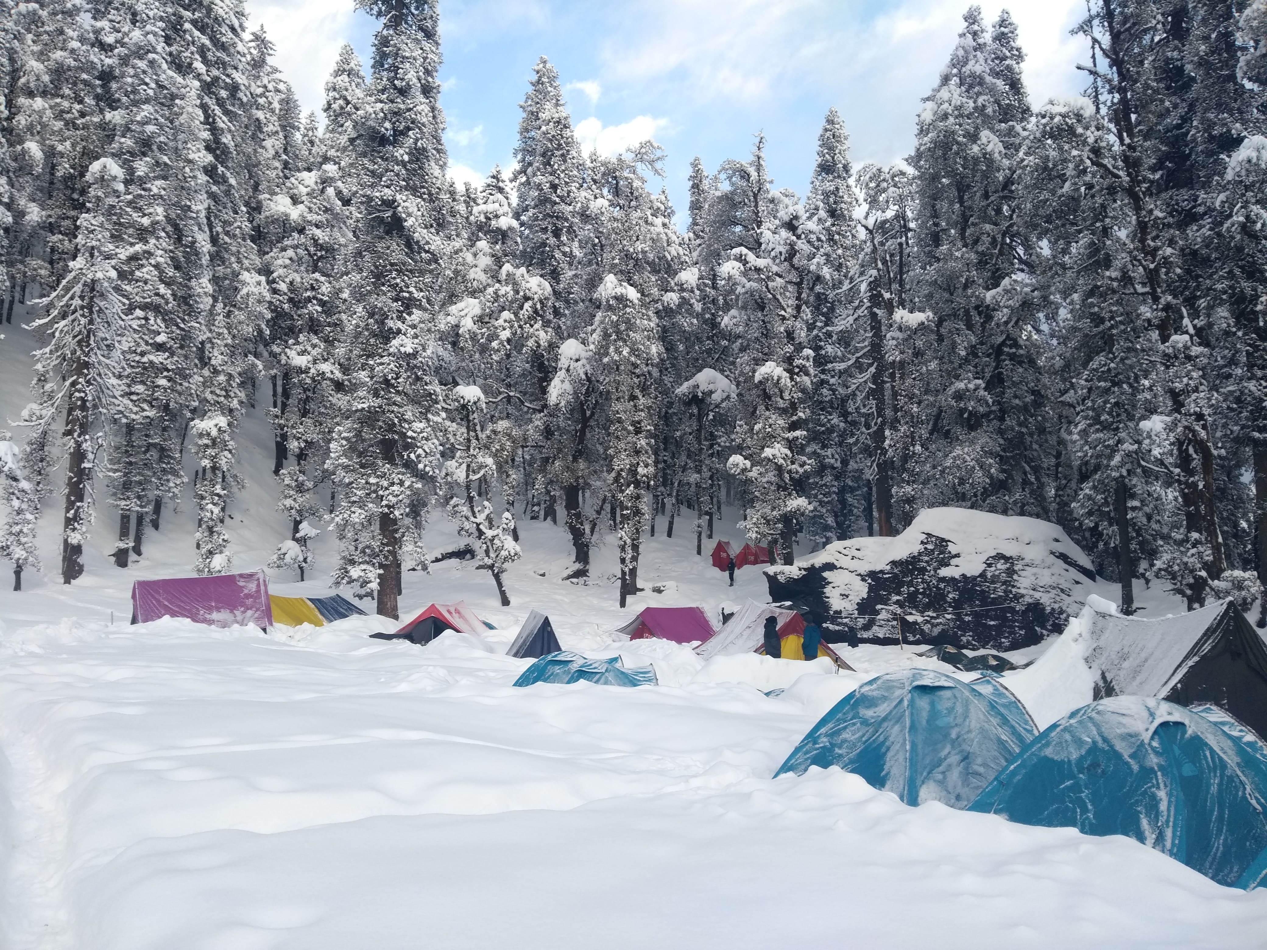
The trek on foot initiates from Allain Guhugal Hydel Project junction. After crossing the main road, take the small path that leads to the forest of pine trees. You will also find other variety of trees like maple, deodar, toss and oak. The sight is refreshing. The slope that is supposed to be climbed is an easy one and not very steep. Twenty minutes into the trek, you will reach a bend that overlooks a lush green meadow strewed with small rocks. Enjoy the surrounding for a couple of minutes and head towards the meadow. The Rani nallah comes into view which flows directly in between the meadow. You will also see few sheep and cows grazing in the field. The sight looks exactly as if taken out from fairy tale. You can pass through the meadow or climb up the hill on the left hand side. Either way you will reach Chika which is at the end of the vast meadow. But, climbing the hill and descending down to Chika is a better and easier route. Chika camp site is a huge, spacious patch of green. The Rani River flowing in the middle makes this place perfect for setting up the tents.
Day 2 - Chika to Balu ka Ghera
The next destination is Balu ka Ghera which is not visible from the Chika camp site, but you can make an idea as it falls to the right. Follow the left bank of the river that will appear at your right hand side. The trail leads the way to a slope of boulders and rough terrain. The path is an easy one and can be accomplished without any difficulty. You will find an entire stretch of the river's right bank lined up with amazing dwarf Rhododendron trees. These trees will cover the lower and the central region and cluster of silver birch trees cover up the upper region. Once you have reached the end of silver birch trees, wait a moment and look back to marvel the entire range of Dhauladhar snow clad peaks in front of you. The view is very picturesque. You will reach a clear stream waterfall to the left at a distant. Best place to fill in your bottles.
After crossing the waterfall, the next route is towards the river to your left. You can go to the other side only by crossing the rivulet by wetting your feet. The water is super cold and will definitely prick your feet. You can also jump from one rock to another in the stream and get to the opposite side. You must have finished half of the day's trek when you enter Jwara. Jwara is a beautiful scenic sheltered valley; huge snow clad rocks at one side and the valley drops down to the river on the other side. You will feel like immersing yourself in the beauty of God's nature. You will find snows melting into the river and cattle grazing the land. In front of the picture is snow clad mountains and behind them lies the Hampta Pass. From here, the trail would be by the river side which will lead you to another rectangular valley. The path is covered with multi colored flowers. The last of the tree lines vanishes out of the sight and is left behind. It will take another half an hour or so to reach the end of the valley, which is the finishing part of Jwara. After Jwara, the path is a slope covered with snows and rocks. The end of the path is Balu ka Ghera, the name has nothing to do with the place. The place is covered with snow and greens whereas the name imply mound of sand. But it is said that this place was formed with the sands and dust deposited by the river. Balu ka Ghera campsite is a flat ground amidst the mountains that you will cross the next day to reach the pass. Balu ka Ghera is at an elevation of 11, 900 ft.
Day 3 - Balu Ka Ghera to Siagoru crossing Hampta Pass
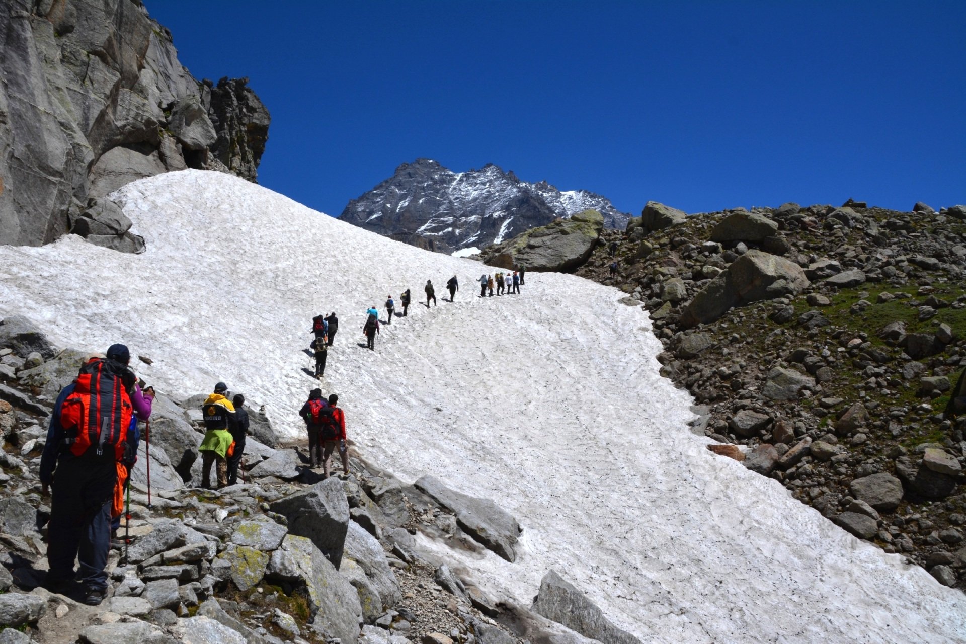
The day's trek encompasses 19 hours. You can split the journey in two halves, a steady ascent on moderate steep slope to Hampta Pass, thence a sharp descent to Sia Goru. The highest altitude will be achieved on this day at Hampta Pass (14, 100 ft). The day starts by heading towards the mountains you spotted the previous day. The trail is along the river side. The view is amazing, tiny yellow and orange flowers give a pleasant picture to the river. The river side trails takes you further to the base and then the actual climb to the Hampta pass takes place. It will take an hour to reach here. Another hour of walk will take you to the first plateau. In summer, the place is completely covered with thick fresh snow. Otherwise, it is just patches of snow everywhere. The Deo Tibet peak will fall right in front of you.
You will reach another plateau and then to a ridge. It will take another half an hour to reach the ridge's end. Then from the first ridge trek further up to get on the second ridge. Hampta Pass is just a few meters and a bend away from the second ridge. The climb to Hampta Pass is a vertical one and is a hard mount. It will take about 15 minutes to reach the pass. Yes, by the time you reach there, you would be extremely tired but the site which enfolds in front of you is stunning. Enjoy for sometime in the pass, relish the beauty around, have your lunch and then get ready for the next descent to Siagoru.
The descent is trickier than the journey to the pass. The decline is so steep that you would not be able to locate the base of the mountain, not even by craning your neck. The best possible way to get down is either by sliding down the slope or with the use of ropes for support. The route is a little meandering too. You will also spot Spiti from this point. In an hour and a half you will reach the base of the valley that will lead you to Siagoru. The valley is secured by snow clad mountains, and the side which is open is Siagoru's way. The trek to Siagoru is easy on flat land. The Siagoru camp site is also by the river side. Set your camps on the grounds and retire for the night with a feeling of contentment at the heart.
Day 4 - Siagoru to Chatru
You will cover Sia goru to Chatru by foot and it will take approx 5 hours of easy downhill trek. Siagoru is placed at an altitude of 12, 900ft and Chatru at 11, 000ft. It is a gentle trek downhill from Siagoru. The trail here again is by the side of the river valley between mountain ranges. Chatru can be located at a distance. No vegetations can be seen in the barren mountains. The tricky part comes next.
You will have to be careful as the trail might sometime lead you to edges of mountains and ridges. The route has slippery parts too. So, sure footed and careful navigation is required to go further. Nevertheless, the trek is not that difficult as it sounds. You will for sure enjoy the sliding and heart pumping mounting. Getting down the mountains will consume another two hours of your time. You will notice the Chandra River flowing below and a road that goes by its side. More than two Glaciers comes next which are to be crossed. The other side of the Glacier is Chatru, the next camping zone. Choose a location which has the river running around. Chatru is a magnificent camping site; it is a consensus of the three passes, Hampta, Rohtang and Spiti. The location is just about another two hours.
Day 5 - Chatru to Manali (drive)
A ride back from the Chatru camp site to Manali is scheduled for day 5. After this 7 hour journey full of mellow reminisces of the hills, you will be reaching Manali in the evening. An overnight journey after 06:00pm to Delhi will hopefully work out best.
Risk & Respond
High Altitude Treks?: Risk and Response A high altitude trek calls for an adventurous attitude, but embarking on an adventurous trip without calculating the risks is utter stupidity. That’s why we have listed a few risks and the response planned by Apex To Himalaysto minimise or address the risks in the best possible way.
Risk: Altitude Before you start the trek, it is important to understand the implications of high altitude on your body. Be aware of symptoms of AMS (Acute Mountain Sickness) like mild headache, nausea and general discomfort.
Response: If you feel any of these symptoms, inform the trek leader on priority and follow his instructions. Every campsite has as stretcher, fully equipped first aid kit, oxygen cylinders to address the situation.
Risk: Weather Weather is unpredictable in the Himalayas. Though we are always observant about the changing weather, no one can guarantee a snowfall, rain or Sun. Do understand that your security is of utmost importance to us and we will not proceed any further from the campsite if the weather is not favourable.
Response: The decision of the Trek Leaders and Guides to proceed or wait for the weather to get better will be final.
Risk: Injuries Often, while trekking over difficult terrains, you might have minor injuries like leg sprain, bruises etc. Serious injuries like fractures or major cuts are very rare.
Response: All our Trek Leaders are Certified Wilderness First Aid responders. They are trained to handle emergencies and can tackle minor injuries with a well-equipped first aid kit. In case of serious injuries, the patient is carried on a stretcher to the nearest road-head and is led to nearest medical centre.
Risk: Lack of communication devices In the remote areas of the Himalayas, mobile networks do not reach. On a trek, one is cut off from the world of calls, SMSs or watsapps.
Response: We rely on walkie-talkies and runners to communicate between the campsites and the base camps.
Included
- Transport: Dehradun to Manali and Return.
- Meals while on trek (Veg. + Egg).
- All necessary entry fees and permits.
- Accommodation:- Guest house, Home stay, camping during Trek.
- Mountaineering qualified & professional trek Leader, guide, cook and Support staff.
- First aid medical kits, stretcher and oxygen cylinder.
- Trek equipments: Sleeping bag, mattress, tent (twin sharing), kitchen & dinning tent, toilet tent, utensils and crampon (if required).
- Apex To Himalays Staff Insurance.
- Porters/mules to carry central equipment.
- Any kind of personal expenses.
- Food during the transit.
- Mules or porter to carry personal luggage.
- Insurance.
- Any kind of emergency evacuation charges 6. Anything not specifically mentioned under the head.
Excluded :-
How to Reach
By Air :-
Bhuntar, which is 52 km away from Manali, is the nearest airport. Taxi services are available from Bhuntar to Manali, which costs about Rs. 700- Rs1000. Bhuntar is well connected to Delhi by air. The airliners that take you to this Airport are Indian Airlines, Kingfisher airlines, MDLR Airlines and Jagson Airlines, operating flights from Delhi and Chandigarh to Kullu.
By Train :-
Take the overnight train to Chandigarh from Delhi
By Bus:-
Manali is well connected to Delhi. Take an overnight bus from Delhi to Manali. Tickets can be booked online at www.redbus.in or www.hrtc.gov.in, Tip: Since Delhi Manali is a long journey most Volvo private buses leave Delhi between 5 pm and 6 pm. The last govt bus leaves at 8.30 pm from ISBT Kashmere Gate. Manali to Delhi Like the onward journey, buses leave from Manali to Delhi between 4 and 5 p.m. Your tentative arrival at Delhi may be anywhere between 6 a.m and 10 a.m. Plan your onward journeys only post noon giving enough buffer for bus delays.
Note:- Trekkers need to take only those VOVO buses which reach Manali till 11.00am on first day. Our reporting time is 12.00pm at Manali but in-case you will not able to reach at meeting /briefing time, either we will transfer your seat to our any next batch or we will cancel your trek, so please double check your bus time with your bus transporter.
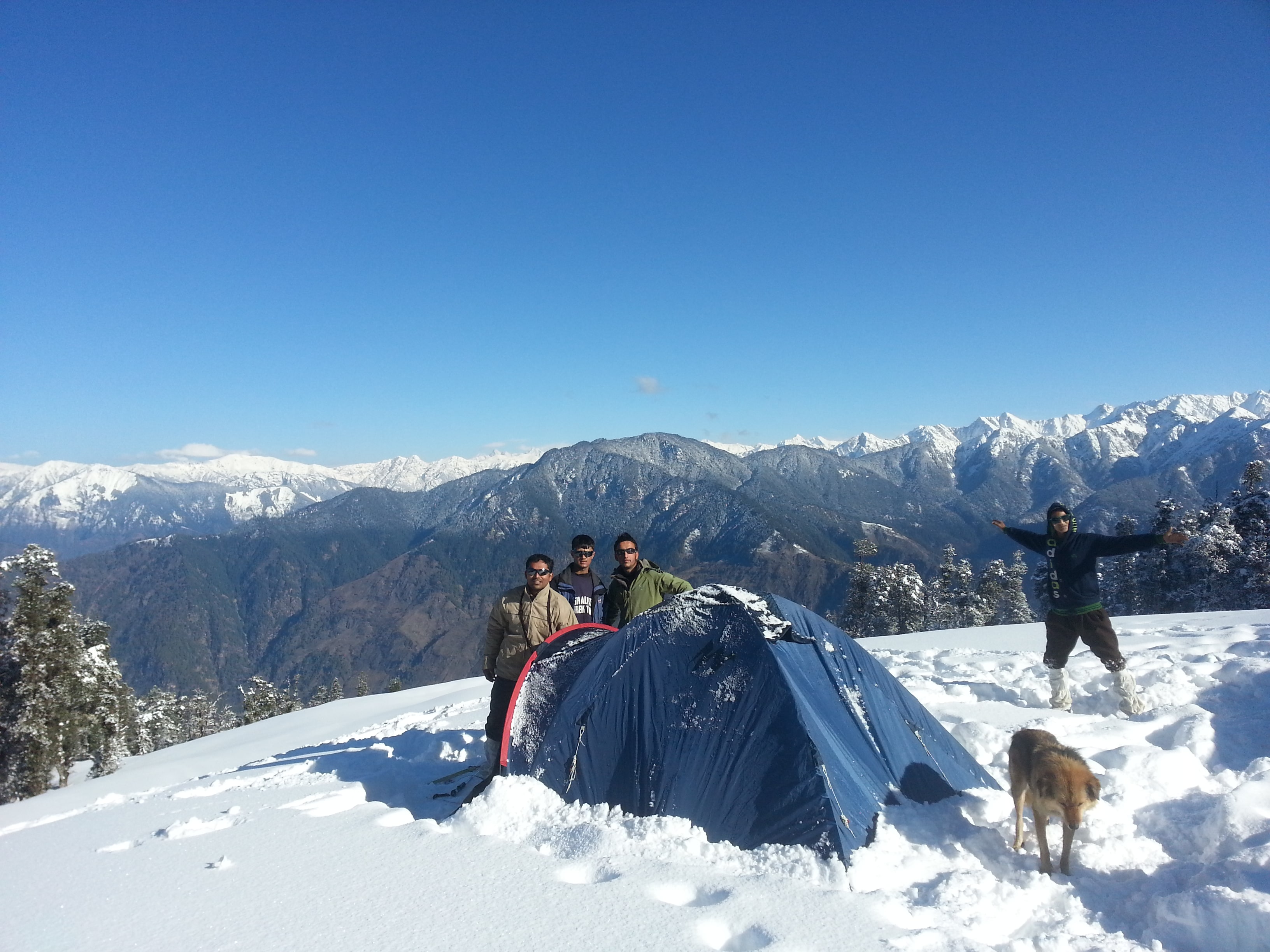
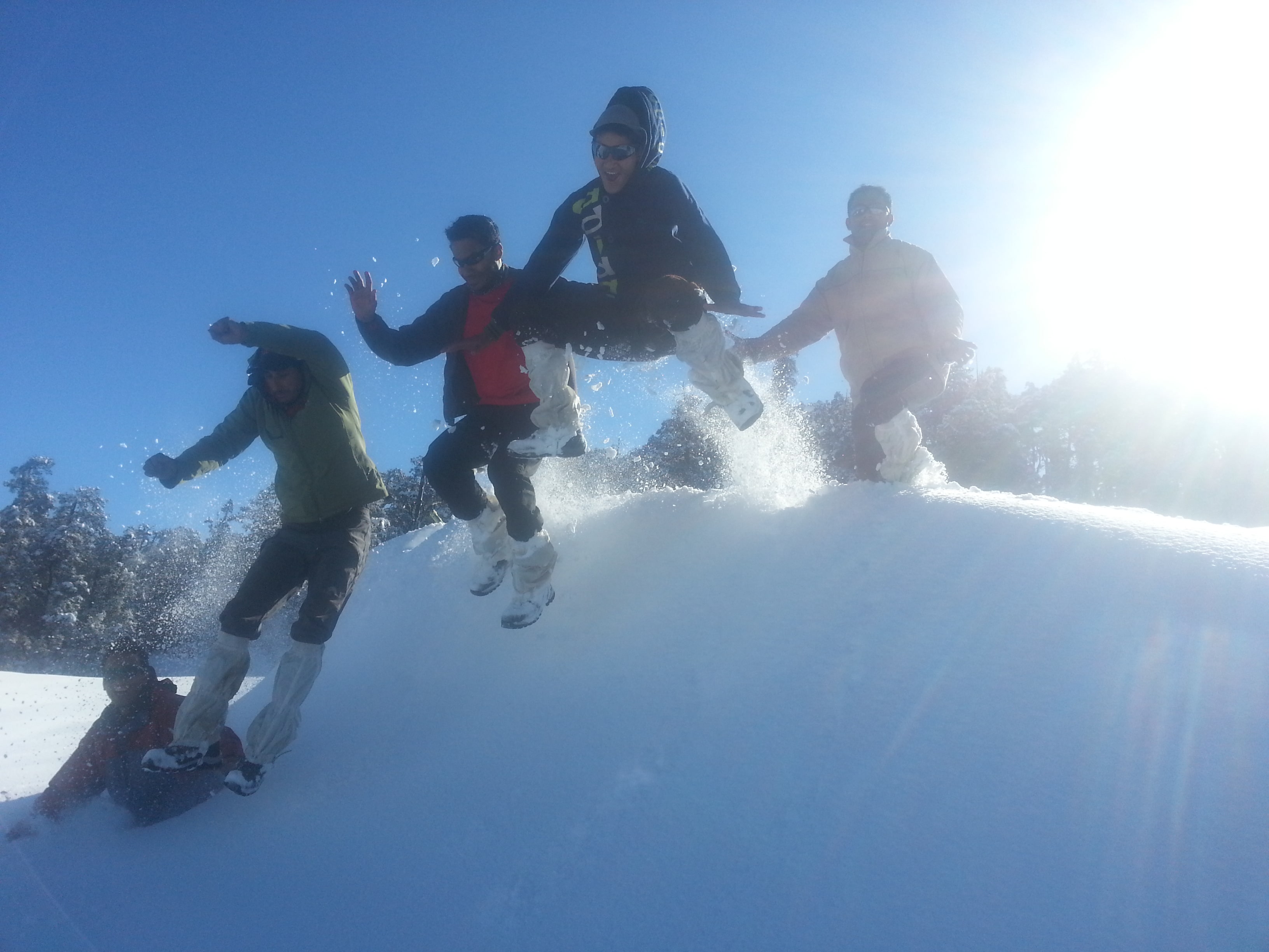
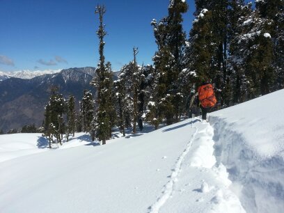
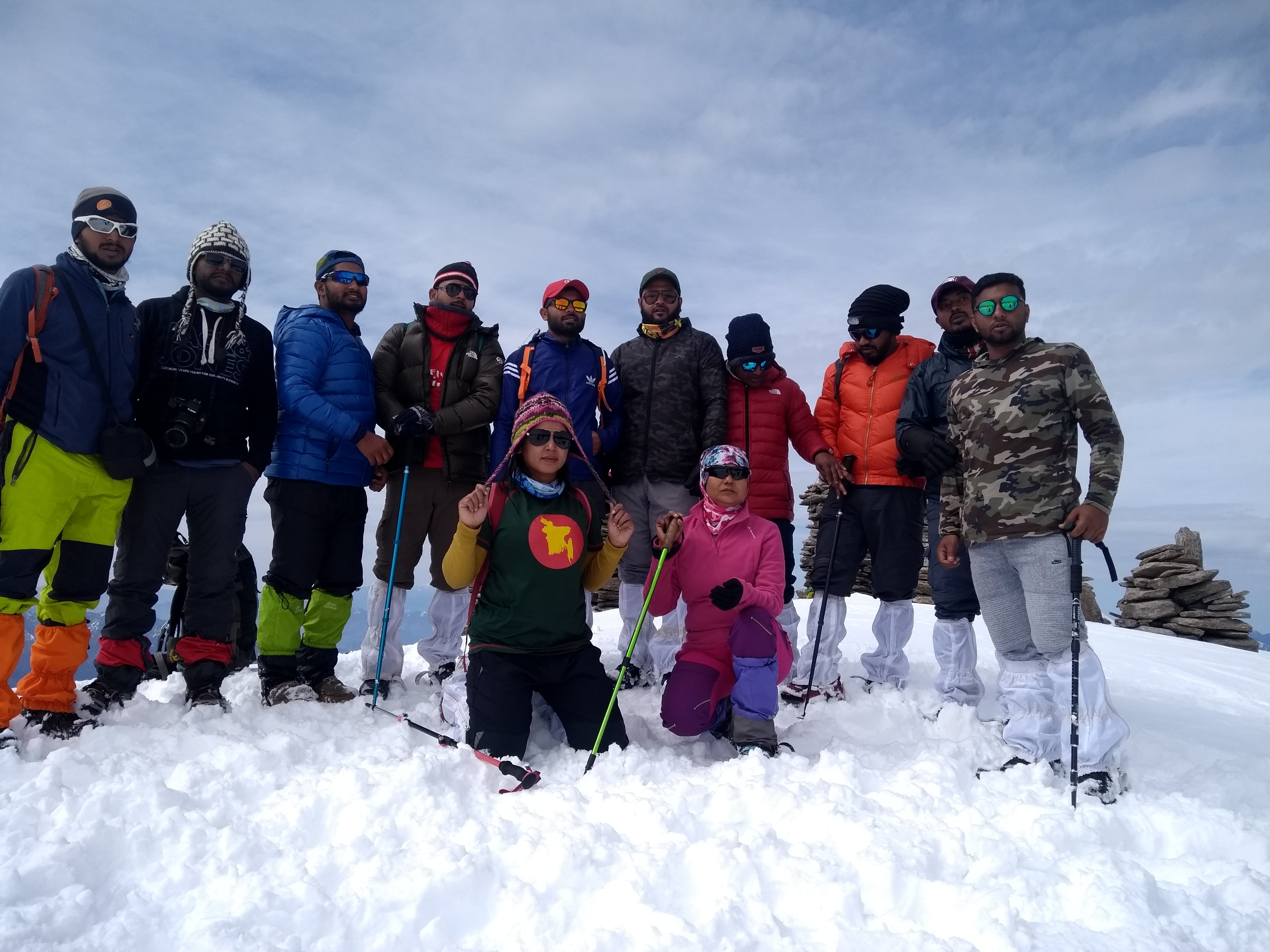
Photo Gallery


Quick Links
About Us
Photo Gallery
Enquiry
 Buy Online
 Buy Online
Tour Packages
Harki Dun Valley Balipass Trek Borasu Pass Trek Runsara Lake Trek Phulara Trek Kedarkantha Peak Trek Rupin Pass Trek Nag Tibba Trek Sarul Tal Trek Valley of flower Trek
 Camping with Bonfire
Adventure Activities Rafting Zip Line Rappelling Camping
Average Temperature: Summer temperatures: Day time: 8°C-15°C; Night time: -5°C-3°C